Following the groundbreaking announcement from Grant Shapps of the DfT’s support for active travel and the Mayor of London’s Streetspace Plan, London Living Streets sets out the key measures for walking that will be essential for the revival of London’s economy and quality of life.
On Saturday 9th May, transport secretary Grant Shapps MP, outlined unprecedented government support for active travel in the UK, making it clear that this is “a once in a generation opportunity to deliver a lasting transformative change in how we make short journeys in our towns and cities”.
This followed the mayor of London’s announcement last week of a Streetspace plan to accommodate a possible five-fold increase in walking and ten-fold increase in cycling in London as lockdown restrictions are eased.
The scene has been set by politicians. Now it is down to the highway authorities that control London’s roads (the 33 boroughs and Transport for London (TfL)), to take this opportunity and respond with radical programmes for real change.
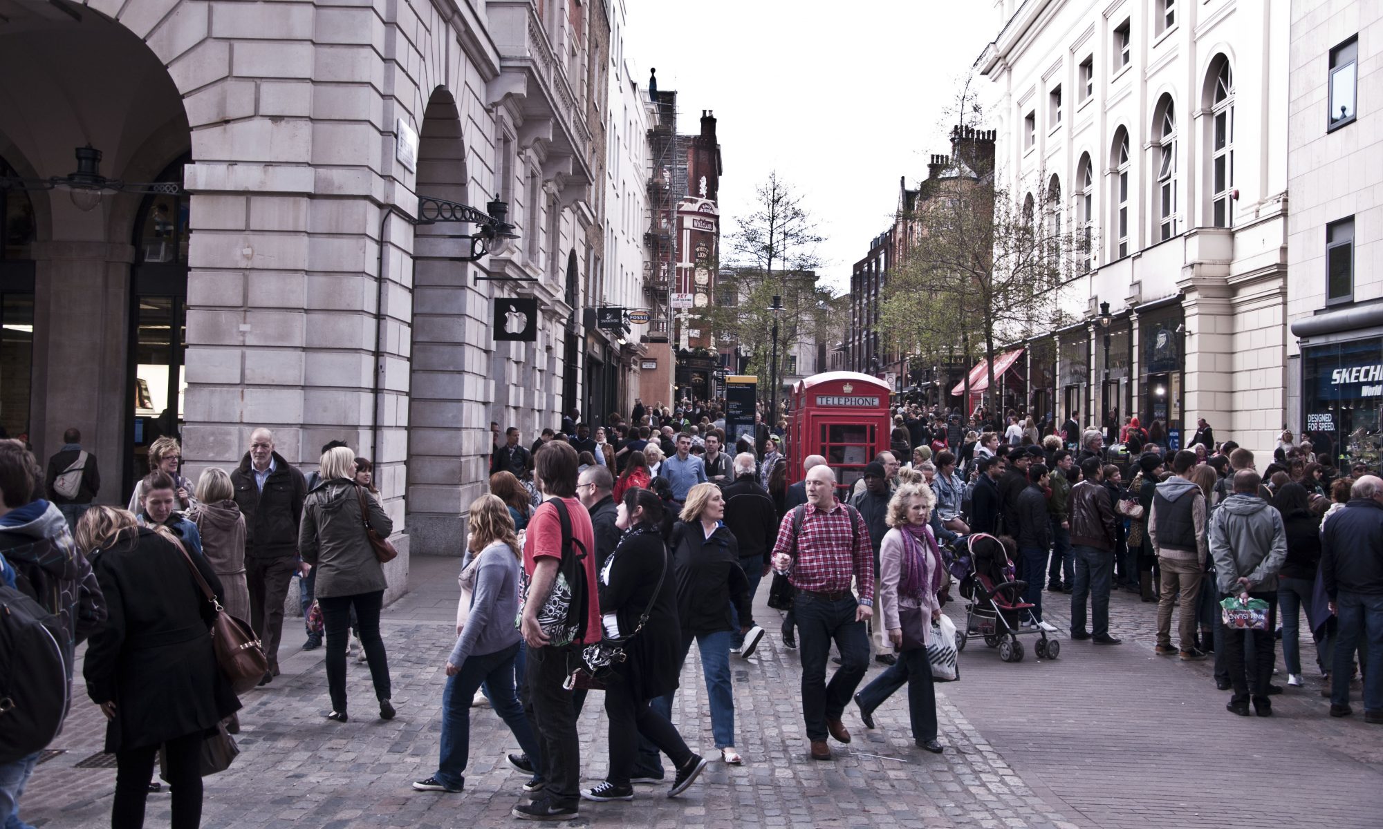
While there has (rightly) been a focus on the transformations that will enable more cycling, less has been said about what the millions of Londoners who walk every day need. It is important to remember that even before the lockdown, a quarter of all trips in London were made on foot. A third of trips made by Londoners as a driver or passenger could also be walked in less than 25 minutes.
Walking holds the key to London’s recovery from this crisis. People will continue to rely on local shops and will need more space to queue outside them. When cafes, restaurants, pubs and bars start to open this summer, they will need more street space for tables in order to survive. As Londoners return to work, they will walk further as part of the daily commute to avoid buses, Underground and trains. They will also choose to walk in order to retain the health and quality of life benefits they enjoyed in lockdown. Maintaining current air quality will also be critical.
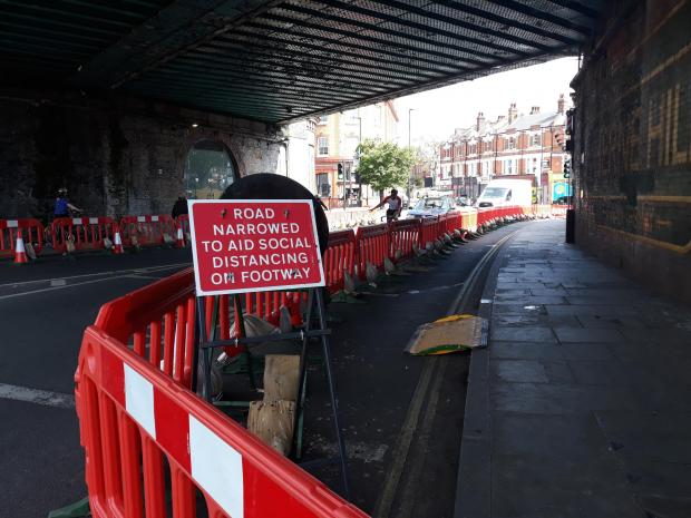
All of these changes require a context of slow vehicle speeds to help people be and feel safe. Where boroughs have not already introduced a default 20mph speed limit, now is the time to introduce them or at the very least ensure that they are widespread across town centres and all residential areas.
Our proposals, listed below, enable Londoners to get to where they need to be and help us recover from the terrible crisis we have all faced together.
1. More space for local shopping, eating and use of local services
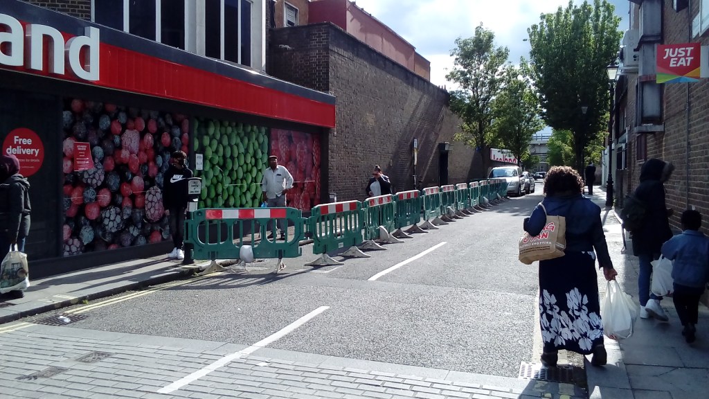
Enabling safe social distancing for local shopping trips is key as many people continue to work from home as the lockdown ends. This is vital to support the local economy and to provide the many Londoners who do not own cars with safe, easy and frequent access to their local shops.
London’s restaurants, cafes, pubs and bars will also need more street space when they start opening, possibly in July, to allow them to survive in a new era of social distancing.
A wide range of interventions are possible here and include:
- Wider pavements
- Kerbside car parking removal
- Key corridors for bus and cycles only (buses limited to 10 or 15mph as on Tottenham Court Road)
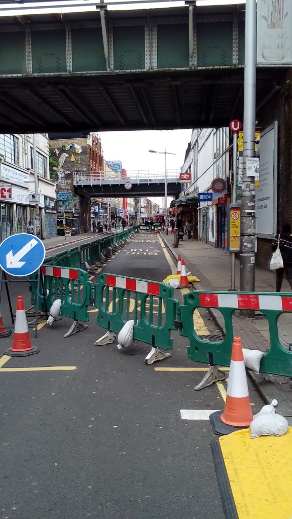
- Protect local areas from through-traffic by rapidly employing low cost filtering of streets (eg by use of planters) and neighbourhoods for example through Low Traffic Neighbourhoods (LTNs)
- Removing the need for pedestrians to initiate “green man request” by pressing buttons at light-controlled junctions with pedestrian phases
- Reduce/eliminate the wait time for pedestrians at light-controlled crossings; increase the ‘green man time’ on crossings
- Filtering streets (and surrounding streets) to improve the pedestrian environment (such as on Broadway Market in Hackney)
- Removal of pedestrian guard rails, especially at crossings to avoid crowding
- Pedestrianising streets (lunchtime to 10pm?) where there are concentrations of cafes, bars and restaurants to use more of the public realm to facilitate good social distancing, keeping staff and customers safe and supporting the revival of the local economy.
2. Walked and run commuter journeys
London needs connected, quiet streets so walking and cycling become the natural, safe, healthy option both for short and longer distances. We’ll need to walk more as part of the daily commute and we’ll need safe space to access local shopping streets and parks for exercise as we work more from home.
The fastest way to achieve this is with low-traffic neighbourhoods (more here). These are being delivered across London, but we need more. They can be delivered at a fraction of their usual cost with a few well-placed planters to create 1-1.5km cells, bordered by main roads.
This is not about encouraging walking, but enabling it with a vast amount of new space. It’s also a choice between opening the flood gates to a huge increase in cars on our residential streets, directed by SatNav, or opening them to forms of transport that all Londoners can do and that won’t damage our health.
Walking networks will also help Londoners consider longer walked journeys in Central London, taking pressure off public transport when they return to work
The Central London Walking Network (CLWN) connects transport hubs with safe, healthy and enjoyable walking routes. TfL has funded London Living Streets and Urban Good to produce a beautiful map of the network, to be published later this summer.
This network relies on rapid delivery (using temporary measures) of improvements both on the TLRN and borough roads to provide safer crossings and more space for people walking along these routes.
A priority will be improvements at mainline stations to ensure walking is the natural option for onward journeys. Barriers to overcome include:
Euston and Kings Cross Stations – fundamental changes on crossings on the Euston Road to enable safe pedestrians flows south to the City and West End. In addition, the closure of Pancras Road (between King’s Cross and St Pancras stations) at its junction with Euston Road. Taxis and other traffic would enter and exit from the north.
Marylebone Station. Crossing the Marylebone Road.
Victoria Station. Eastwards movement across the Inner Ring Road.
London Bridge Station. Safe social distancing crossing London Bridge.
Liverpool Street Station. Ease of crossing Bishopsgate to the Eastern Cluster. Bishopsgate cannot continue to function as a major arterial road in the present circumstances.
Waterloo Station. Crossing York Rd; safe social distancing crossing Waterloo Bridge.
Charing Cross Station. Improved crossings of The Strand.
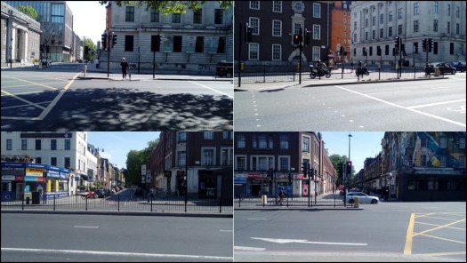
TfL’s Strategic Walking Analysis identifies a significant number of areas in Central London which feature both current high pedestrian density and high walking potential, and are a high priority for improvement.
Across London We also propose extending London Living Streets’ walking network concept to Inner and Outer London to make walking the easy and safe option between town centres, workplaces and transport hubs.
Longer walked commuter journeys are eminently possible and many people have taken up longer walks and running during the lockdown. But improvements such as fairer allocation of space between people and vehicles, wider footways, car parking removal, improved crossing facilities (see above) and Low Traffic Neighbourhoods must be delivered for these to be enabled.
London boroughs should prioritise work using TfL’s Strategic Walking Analysis (see below) that identifies a large number of transport hub and town centre locations outside Central London which combine high pedestrian density and walking potential with relatively low levels of active trips per day.
The following are ten locations (identified from the SWA) which are candidates for the rapid development of walking networks: Romford (Havering), Ilford (Redbridge), Edmonton (Enfield), Wimbledon (Merton), Croydon Town Centre, Lewisham Town Centre, East Sheen (Richmond), Hounslow Town Centre, High Barnet (Barnet), Wandsworth Town Centre and Sutton Town Centre.

3. Walking to school, colleges and other childcare settings.
We propose the low-cost roll out of School Streets wherever possible across London, with pavement widening outside those schools sited on main roads. There is also the potential to extend this approach to wider networks of streets adjacent to schools and to tie them into the introduction of Low Traffic Neighbourhoods as well as linking them in with behavioural changes programmes such as Walk to School.
4. Walking for daily exercise and leisure
Increased walking during the lockdown is something that we do not want to lose. Research shows that regular moderate exercise reduces the risk of viral infection and the likelihood of dying from such an infection.
The key to maintaining the levels of walking could be removing barriers to safe access to local or major parks and other green and open spaces (an example of addressing this is the initial work of Lambeth Council at Herne Hill). Again, there is the potential to tie this in with early delivery of Low Traffic Neighbourhoods or other street filtering.
If the visitor economy is to return safely, the existing unfair allocation of space in locations such as Westminster Bridge needs to be addressed. More pedestrian capacity can also be delivered with widened pavements and bus/cycling/emergency vehicle-only streets. Proposed improvements, for example at Parliament Square and the Strand, should be implemented, potentially initially using low-cost temporary measures.
Is there also an opportunity for an iconic summer streets intervention to give people large amounts of street space in Central London, for example a weekend closure of the Victoria Embankment between Westminster Bridge and Blackfriars Bridge?

Next Steps. We need to show that there is widespread support for these measures. You can help ensure they are introduced:
- Contact the Leader of your Borough and local councillors to ask them to take radical measures to support walking locally
- Email a letter to your local newspaper
- Persuade your neighbours of the benefits of walking and measures to enable people to walk. Post COVID-19 this is the new normal!
With contribution from Victoria Lebrec
